I’m back, getting into the swing of things again. I appreciate you dropping by the site.
Today’s topic is visualizing the Anthropocene. Not familiar with the term? Well, the Anthropocene refers to current geological chronology. You may be more familiar with geological ages such as the Pleistocene, the Ice Age, or the Cambrian, when the Earth experienced an explosion of biodiversity leading to all of the life forms we see today. Well the Anthropocene has become the term to replace a geological period we formally called the Holocene, stretching back 10,000 years to the first organized human settlements and the agricultural revolution. The Anthropocene means the Age of Man and a Canadian scientist, Felix Pharand-Deschenes has used satellite images to map our impact in a visually stunning way. Some of those images I have reproduced here.
The Anthropocene is more than just the glowing lights you see in these pictures. It covers our contribution to changes in atmospheric carbon with CO2 reaching levels in the atmosphere not seen in 15 million years. It doesn’t show how fertilizer runoff is creating vast algae blooms in our oceans and lakes leading to oxygen depleted water where fish and other sea life cannot survive. It doesn’t show the deforestation caused by our need to increase agricultural land use to feed our growing population. Nor does it show us glaciers and ice caps in retreat, or increasing desertification in the Sahara and other Earth deserts.
Use your right mouse button to click on this first image to enlarge it and see the human impact on a number of key metrics that include everything from CO2 levels to motor vehicles to McDonald’s restaurants.

The next image is a view of Canada and the Northern United States. You can right mouse click on it to see it in greater detail. Undersea cables stream from both the Atlantic and Pacific coasts. Note just how significant our transportation and urban network has become.

Next we have an image that shows Europe and much of Africa. Treatment is similar to the satellite image of North America. You can see undersea cables crossing the Atlantic and Mediterranean, transportation networks and the distribution of cities. Note the difference in density between Europe, Africa and Saudi Arabia. As our world population increases much of it will be in the Developing World. Expect the Sub-Saharan parts of Africa to look more like Europe by 2100.

In our final image you can view how Asia appears today. Much of Central Asia is mountainous or desert and you can see how this has influenced human settlement. As China’s population continues to age we shouldn’t see significant changes in urban land use but India and other parts of South Asia are another story.

I am sure you find these images as compelling as I do. They illustrate just how much we humans are impacting the planet today. What will they look like in 2100? With India at that time projected to be the most populous country on Earth, and Africa’s population expected to double, what will we see from space?
The Anthropocene has just begun and we humans are now a part of the geological record.
Related Posts
 How Close Are We To A One-And-Done Vaccine For COVID-19 And Other Viruses?
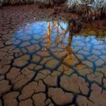 Globally Groundwater is Vanishing From Human Over Exploitation
 U.S. Using A Supercomputer To Help Communities Model Climate Risk
 Navigating the Future: AI and the Power Grid
 Earth Day 2024 And The Atmosphere Is Raining Microplastic
 Daylight Savings Time, Standard Time, Is There Science Behind Our Twice Annual Shift?
 The Nuclear Arms Race Never Ended
 Can Artificial Photosynthesis Be The Key to Mitigating Climate Change?


[…] Canada made the news last week not just for the wildfires that continue to rage across a number of provinces, but also because of a little-known post-glacial lake just to the northwest of where my wife and I live. The place is called Crawford Lake. It is the principal feature of a conservation area that goes by the same name. And earth scientists studying its lake-bottom sediments called varves believe they provide the quintessential evidence of our geological footprint on the planet and the beginning of the Anthropocene Epoch. […]