
Three stories you may have missed involving the ocean that I describe as good, bad and worst. They include:
- The promise of MFCs (Microbial Fuel Cells) invented to power long-duration ocean-monitoring sensors;
- A damaging picture from satellite data showing oil slicks covering 1.58 million km² (610,000 m² or twice the size of Texas) of the ocean surface annually;
- The threat posed by the current El Niño is expected to raise ocean levels along North American coastlines and combine with tides to decimate Pacific coastal communities.
The Good: Fuel Biocells to Help Monitor Ocean Health
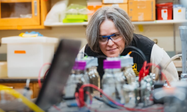
Hydrogen fuel cells have been used to provide backup power to utilities and electricity for on- and off-road electric vehicles. These are not the fuel cells that Michigan Technological University is developing. Led by Amy Marcarelli, Professor of Biological Sciences (see picture at the beginning of this article), her research team is developing self-refuelling power supplies for underwater sensors called MFCs (microbial fuel cells) that harvest electricity from living marine biomass.
Called BLUE (BioLogical Undersea Energy), the Defence Advanced Research Projects Agency (DARPA) of the United States is providing the funding to make bacteria-powered fuel cells a reality.
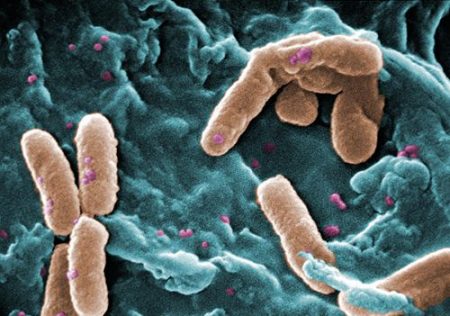
Marcarelli describes how MFCs generate electricity to power devices.
“The basic idea is that microbes move electrons around during their metabolic processes. In a microbial fuel cell, those processes transfer electrons from an anode to a cathode, creating an electrical current we can harness.”
The Argo Programme, a worldwide wiring of the oceans with approximately 4,000 floating and underwater sensors, relies on non-rechargeable batteries for power. Most sensor packs use lithium-ion batteries, which last between 3 and 6 1/2 years. Argo sensor arrays are seldom recovered (only 10 were in 2024). MFC-powered sensor arrays could eventually replace many.
The research points to a deficiency in relying on MFCs exclusively. Not every part of the ocean produces sufficient volumes of biomass to feed the microbes to produce more electricity than they need to thrive, and enough to power a sensor array. What has been developed to date works in ocean wastewater environments where there is lots of biomass. Not so much elsewhere.
The Bad: Oil Slicks Annually Twice the Size of Texas
A conservation not-for-profit, SkyTruth, is studying satellite imagery of the world’s oceans and has discovered a sickening reality. Every year, an oil slick twice the size of Texas covers parts of the ocean. The oil slicks come from cargo ships (81%) and offshore oil industry infrastructure, with 90% occurring within national territorial waters. The map below shows in orange where these oil slicks are found.
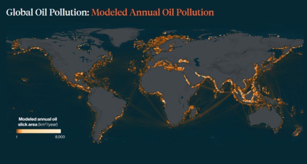
The highest concentrations are found in the Middle East (Red Sea, Persian Gulf, Mediterranean and Black Seas) and off the coasts of Africa and Indonesia. Even marine protected areas are affected, with oil pollution found in the habitats of some endangered marine species.
Ships operating under flags of convenience (Palau, Panama, Malta and Cyprus) are the leading guilty parties, along with offshore facilities in Indonesia and Nigeria.
The Worst: Danger of Pacific Coast Flooding from El Niño
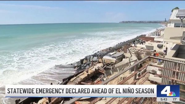
The Governor of California, Gavin Newsom, issued a warning to California coastal communities of a statewide coastal flooding threat. Declaring a state of emergency, he mobilized resources to be prepared for more intensive winter weather caused by what is being described as a “historic El Niño storm season.”
El Niños are getting stronger faster in the 21st century. They are 36% stronger than before the modern Industrial Age began, with16% of that total having happened in the last four decades.
The scientific community is not unanimous in linking recent El Niño changes to human-caused global warming. The above data are purely observational, and whether meteorologists and climatologists totally agree or not, it is hard to ignore the correlation between warmer global atmospheric temperatures and the mid-Pacific Ocean phenomenon that is subsequently impacting weather across much of the world.
The El Niño Southern Oscillation, or ENSO, is the scientific term for fluctuating ocean temperatures that occur in the central and eastern areas of the equatorial Pacific. The cycle includes El Niños and La Niñas, opposite phases of this naturally occurring climate pattern. El Niños are characterized by warming ocean surface temperatures. La Niñas are cooling phases.
A multi-year recent study by the World Meteorological Association (WMO) had predicted that by May 2026 we would see rapidly rising ocean surface temperatures that would begin creating El Niño conditions that would create, by July-August 2026, above-normal land surface temperatures and signficant changes in rainfall patterns that would persist through to February 2027. The WMO climate update for September through November predicts sea surface temperatures in the Central Pacific reaching 3.6°C degrees above normal.
Governor Newsom’s state of emergency proclamation describes how California’s fall and winter could be dangerous, with “repeated rounds of heavy rain, strong winds, mountain snow, flooding, landslides, debris flows, large waves, and coastal flooding, especially when storms hit during very high tides. For families, that can mean roads closed by flooding or rockslides, power outages, neighbourhoods cut off, damage to homes and businesses, and fast-changing conditions that leave little time to react.”
In other words, PREPARE FOR THE WORST.