
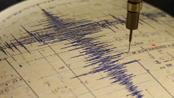
The latest from artificial intelligence (AI) has geoscientists looking at the technology to study seismic data records and hence help to see unforeseen signs of future earthquakes before they happen.
Earthquakes occur from movements in the Earth’s crust. These movements happen where there are active volcanoes, and along fault lines formed by the planet’s tectonic plates.
Earth’s Surface: A 100+ Piece Jigsaw Puzzle
We think we live on solid ground, but we don’t. The Earth’s crust floats on a hot, viscous-solid but ductile layer called the mantle. The mantle stretches from 35 kilometres below continents, less below oceans, to 2,900 kilometres in depth. It forms more than two-thirds of Earth’s total mass. The upper part of the mantle is more plastic in consistency and moves. These currents are driven by thermal convection from the residual heat left over after Earth formed 4.5 billion years ago. The crust where we live is affected by the convection currents that lie beneath. The convection has produced the current condition of the Earth’s crust, which is broken into 7 major plates that underlie the continents, 7 smaller plates and dozens of microplates. By current accounting, the total number of plates exceeds 100.
From my teenage years, plate tectonics has interested me. As head of the Geography Club in my high school, I contacted John Tuzo Wilson, the Canadian geophysicist and principal architect of plate tectonics, to come speak to the students. Wilson was teaching at the University of Toronto and agreed to a speaking date. We packed the school auditorium, both students and the entire high school faculty. I kept in touch with him after.
It was no surprise when I chose to study geology and geophysics when I graduated. Studying ocean tectonic plates was going to be my specialty after I read Wilson’s theory of how the Hawaiian Islands chain formed. Wilson theorized that the entire group formed as the Pacific plate under them moved over a stationary mantle hotspot, causing volcanic eruptions. The Big Island today sits on top of that hotspot. (I might have followed in Wilson’s footsteps if not sideswiped by an accident that sidelined me for nearly two years.)
Today, we understand Earth’s drifting surface of plates using the Wilson Cycle, which describes the mechanism popularly known as Continental Drift. The consequences of plates in motion lead to separations, joinings, scraping, uplifting and subduction.
The visual evidence stares us in the face when we look at a globe. The west coast of Africa looks like it could fit into the east coast of South America as if the two were jigsaw pieces.
The movement is geologically slow, millimetres annually, until it suddenly isn’t. That’s when the Earth shakes.
Venezuela: June 2026
Two earthquakes struck 39 seconds apart in northern Venezuela last month. Geologists described the two events as a rare “seismic doublet.” The quakes registered 7.2 and 7.5 on the Richter Scale, the method used to calculate earthquake intensity. It is logarithmic, so a difference of 0.3 translates to twice the ground motion and almost three times the energy released from the first to the second quake.
The close timing of the two has proven deadly for thousands of Venezuelans trapped under collapsed buildings, roadways, bridges, and other infrastructure. More than 3,500 have died, over 16,000 have been injured, and there remain tens of thousands unaccounted for.
The tectonic plates that produced the quake are one underlying the Caribbean Sea, and the other under South America. The Caribbean Plate, during normal periods, moves eastward approximately 2 centimetres (less than an inch) per year. The quakes caused an estimated 2 to 3 metres (approximately 6.5 to 9.8 feet) eastward shift for the Caribbean Plate, roughly a century of motion in 39 seconds.
The Pursuit of Quake Prediction Science and AI
Predicting earthquakes until now has proven to be difficult. Early warning signs can be detected by seismometers, accelerometers, tiltmeters and strainmeters installed on the surface or underground. GPS, radar and gravity measuring satellites overhead today can also detect surface movements. Some scientists observe changes in animal behaviour that precede earthquakes. Apparently, we humans have lost that ability. Other than what I have just described, our current ability to predict seismic doublets or single earthquakes is more pseudoscience than real.
That’s where AI can help. Researchers at the GFZ Helmholtz Center for Geosciences in Potsdam, Germany, have been building a historic seismic activity record of earthquakes.
They unleashed machine learning (ML) algorithms to study the record without including human concepts and labels. The ML, when exposed to this unlabelled data stream, worked its way through a catalogue of past events without direction. With this unsupervised learning, it produced findings that identified subtle “earthquake preparatory phases” not detected by the methods and instrumentation used by seismologists and geologists today.
The research appeared in the journal Nature Communications in May of this year. The authors conclude “that the method is capable of identifying preparatory phases (when present), showing potential for operational earthquake forecasting.”